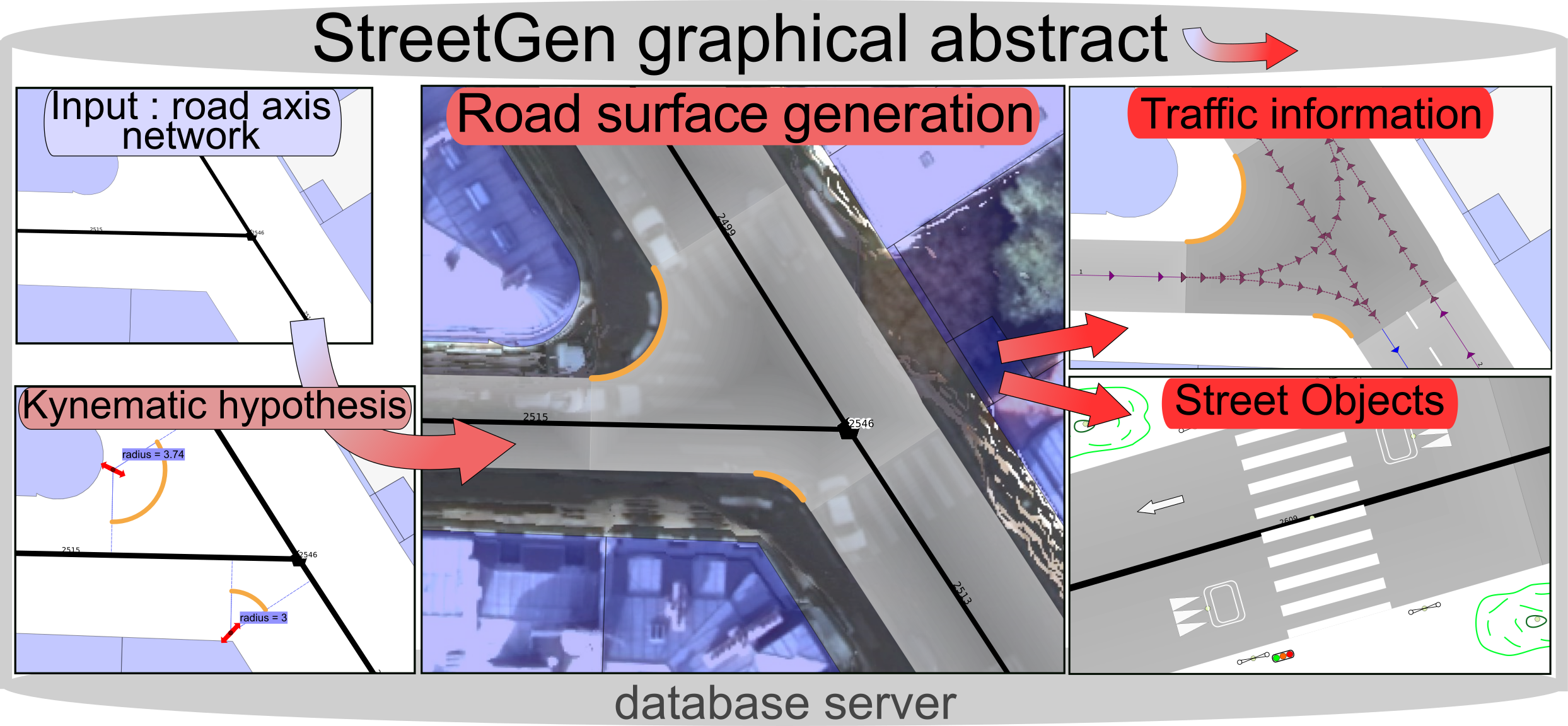
 StreetGen is the method that was developed during the PhD to generate a street model including the road, the traffic information, and the street objects.
Everything (base data, method, resulting street model) is contained within a database, which make it scale nicely and allow concurrent interactive editing.
StreetGen is the method that was developed during the PhD to generate a street model including the road, the traffic information, and the street objects.
Everything (base data, method, resulting street model) is contained within a database, which make it scale nicely and allow concurrent interactive editing.
Abstract
** Procedural modelling of streets**
Streets are large, diverse, and used for several (and possibly conflicting) transport modalities as well as social and cultural activities. Proper planning is essential and requires data. Manually fabricating data that represent streets (street reconstruction) is error-prone and time consuming. Automatizing street reconstruction is a challenge because of the diversity, size, and scale of the details (10 cm for cornerstone) required. The state-of-the-art focuses on roads (no context, no urban features) and is strongly determined by each application (simulation, visualization, planning). We propose a unified framework that works on real Geographic Information System (GIS) data and uses a strong, yet simple hypothesis when possible to coherently model streets at the city level or street level. Because it is updated only locally in subsequent computing, the result can be improved by adapting input data and the parameters of the model. Our street model is based on street axis, and contains geometric information (road surface, sidewalk), topological information (street connection), as well as traffic information and street objects. We reconstruct the entire Paris streets in a few minutes. We tested the usefulness of our model for several applications, such as 3D city building and traffic simulation.
Download link
The thesis manuscript, chap.3 the conference paper (very short) Link to researchgate